|
In the mid-fifties, Detroit was at it's peak.
A population of two million were making a good living
from a manufacturing base surrounding the automobile industry.
This prosperity forced change however and the lure
of new housing on the edge of the city began to put pressure
on the budget of the City Fathers. By 1960 25% of the
population had moved out.
African Americans had also been moving from
the lower east side to the west side, and in particular between Grand
River and Woodward.
This area would become the focal point for the Sixties
Music Industry.
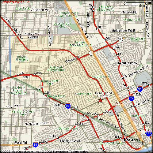
On the map,
Woodward is the orange line
which runs north from the bottom right hand corner.
Grand River is the green line
running north east between the number 10 and the number 5.
To be more specific, most of our sites lie
within the following parameters :-
Start on
Woodward,
about two miles from the river. Head north on Woodward for
four miles where it meets
McNichols
(6 mile road). Travel three miles west to
Wyoming
then three miles south to
Grand River
From there, head four miles south east towards our starting
point.

Notes thanks to David Meikle.
|